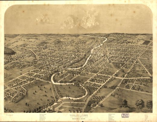
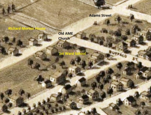
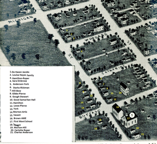
Zoom in and compare how the street developed in twenty-five years. In 1868, the AME church and school and a smattering of houses are clustered around the intersection. By the 1890s, houses filled the east side of Adams and the west side of the 300 and 400 hundred blocks.


